Wanmirr (eagle hawk)
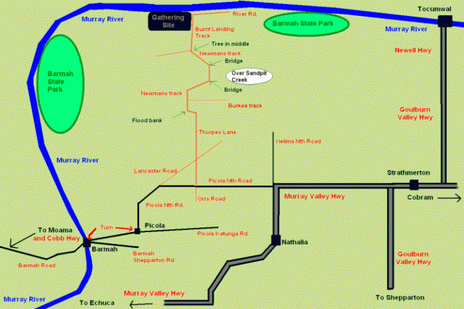
| gathering_map.gif |
Follow the links below for more detailed maps in google maps, although the above mud-map made by sitting owl is possibly the easiest to understand.
For satellite image and road map image overview of area including closest towns and sealed roads:
http://maps.google.com.au/maps?q=barmah+forest&oe=utf-8&client=firefox-a&ie=UTF8&hl=en&t=h&ll=-35.848361,145.162868&spn=1.024082,1.768799&z=9 on these pages you can choose weather to view a traditional road map, or a photograph with a map overlay; choose the tab you want.
For Satellite Image and road map image of property boundary:
http://maps.google.com.au/maps?q=barmah+forest&oe=utf-8&client=firefox-a&ie=UTF8&hl=en&ll=-35.848361,145.162868&spn=0.016002,0.027637&t=h&z=15
Closer to the gathering markers will be put out along the local roads to help you on your way.
